
Leveraging satellite-detected heat and high-resolution smoke data, onX brings users up-to-date information to assess wildfire risk.
onX, a pioneer in digital outdoor navigation, has updated its Active Wildfire and Wildfire Smoke layers, providing more detail and near real-time updates to outdoor recreators as fires continue to spread across the United States and Canada this summer.
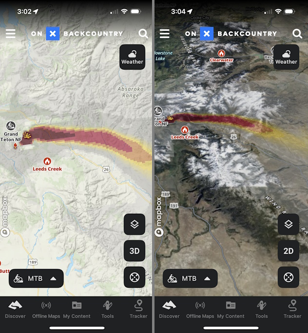
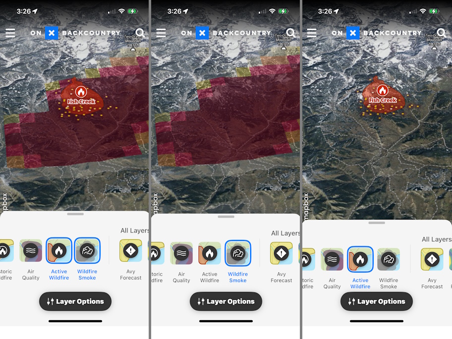
The onX Active Wildfire Layer displays nationwide wildfire boundaries. Sourced from the National Interagency Fire Center (NIFC), outdoor enthusiasts have used this information to understand the perimeters of active fires and avoid them when hiking, mountain biking, climbing, hunting, or off-roading. However, new fires can start in the blink of an eye, and their locations are not always reported quickly.
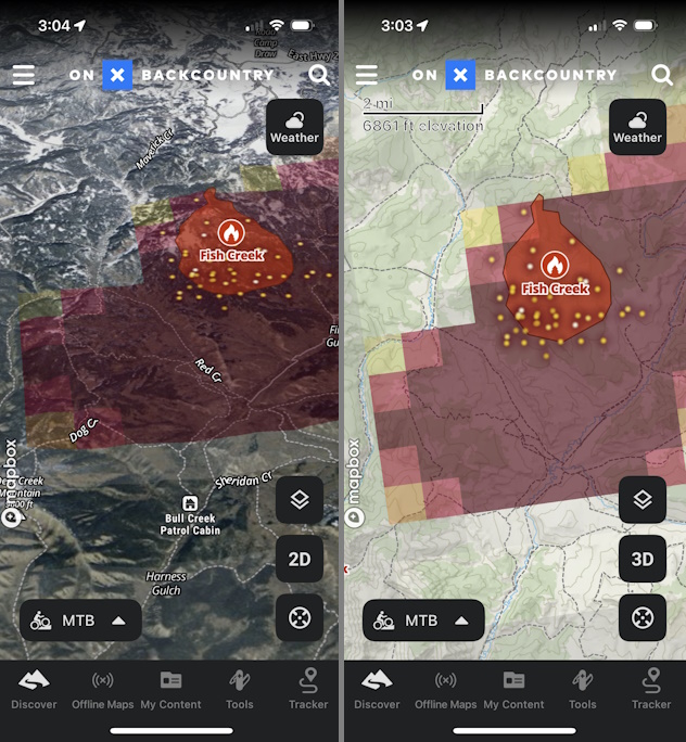
To equip users with the most up-to-date safety information, onX recently added wildfire “hot spots,” sourced by NASA and detected by MODIS and VIIRS satellite sensors. These satellite-detected points of heat are updated hourly and, when overlaid on onX’s maps, can help app users visualize near-real-time conditions–seeing a fire on the map, represented by a glowing yellow dot, well before its perimeter is reported to NIFC.
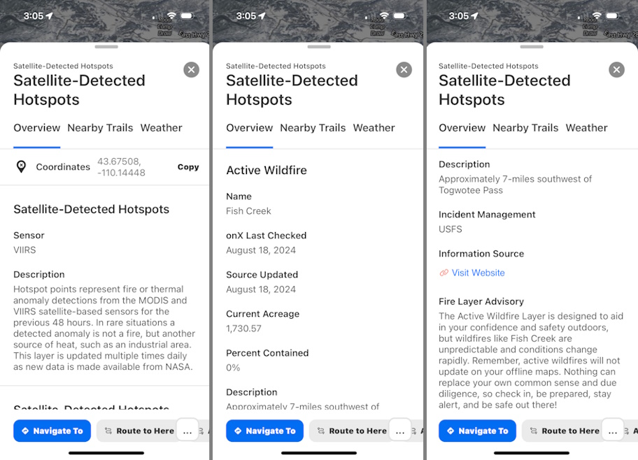
Those “hot spots” can also show how a fire is burning and where the most recent fire activity is located within a perimeter.
“Every once in a while, living in the West, I see a plume of smoke appear on the horizon. But information about that fire isn’t usually available until the next day,” said onX Head of Cartography, Lee France. “With this ‘hot spot’ information at hand, our app users can often see fires that started just an hour ago. As a result, they can make informed decisions on how to alter their outdoor adventure plans and avoid fire hazards altogether.”
“We’ve been watching the steady uptick in wildfires in Colorado, and being able to see the hot spots and perimeter updates, which are sadly close to my parent’s home, have helped relieve some major stress and anxiety,” said onX customer Rebecca Smith.
In addition to this update, the onX Wildfire Smoke Layer shows where smoke from those fires drifts and how dense that smoke is. This new model, sourced from NOAA’s rapid refresh weather model, is also updated hourly, providing onX users with color-coded visualizations of how dense smoke particles are in their neighborhood and potential recreation areas.
“By providing a higher level of smoke detail and recency, in conjunction with our Air Quality Index layer, onX app users can better understand where they can find clean air to recreate and places they should avoid,” said onX Senior Director of Geospatial, Brian Riordan.
The updated Active Wildfire and Wildfire Smoke layers are currently available with a basic membership in the onX Backcountry, onX Offroad, and onX Hunt apps.
About onX
Founded in 2009, onX is a pioneer in digital outdoor navigation, developing software that helps inform, inspire, and empower outdoor recreationists. onX Hunt, onX Offroad, onX Backcountry, and onX Fish make up the company’s suite of apps and are built by explorers for explorers. Because off-the-beaten-path experiences are at the heart of what onX does, the company also leads initiatives to protect and expand access to public land. Since 2018, onX has worked with various partners to secure and improve public land access through direct funding and by supporting key legislation with data analysis and research. Learn more: www.onxmaps.com/about